Functional Areas -
Infrastructure
The deployment of state-of-the-art infrastructure will enable the ERATOSTHENES CoE to conduct cutting edge research in all the thematic areas identified by ERATOSTHENES CoE as well as provide the competitive advantage required to conduct innovative and integrated basic and applied research. The availability of this state-of-the-art infrastructure in all relevant areas will provide additional research opportunities to the ERATOSTHENES CoE.
During RP3, infrastructure activities for the ERATOSTHENES CoE focused on the procurement procedures, contracting, receiving, installing, and operating of the strategic equipment and state-of-the-art infrastructure, such as the Ground-based Remote Sensing station (GBS), the Satellite Data Acquisition Station (DAS), the Solar infrastructure equipment, the computing infrastructure of the Center, the equipment for the Agriculture sector and the Geodetic equipment. In addition, tender procedures for the acquisition of personal laptops, monitors and computing desktops were finalized in order to ensure the smooth operation of the Centre. Moreover, ERATOSTHENES CoE’s infrastructure department has undertaken all the necessary processes to deliver a new building through CUT’s commitment, in order to cover ERATOSTHENES CoE’s increasing needs.
GROUND-BASED REMOTE SENSING STATION (GBS)
The infrastructures of the ERATOSTHENES CoE include a series of comprehensive suites of the strategic and state-of-the-art infrastructures. These capabilities enable the ECoE to conduct innovative and cutting-edge research. This wide range of resources to conduct research on Earth’s climate are categorized by:
- Ground-based Remote Sensing station (GBS)
- Satellite Data Acquisition Station (DAS)
- Science data products
- Modeling
- Computing resources
- Agriculture sector and Geodetic equipment.
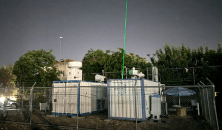
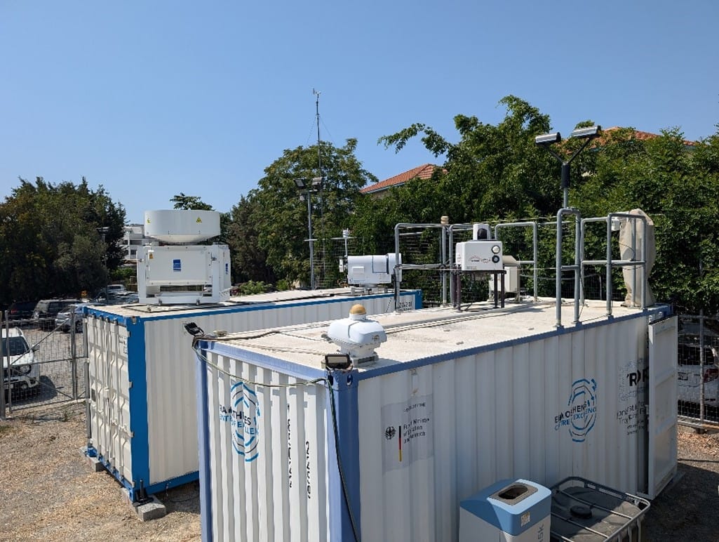
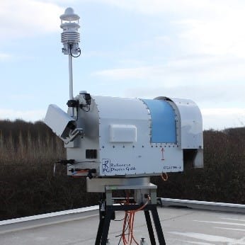
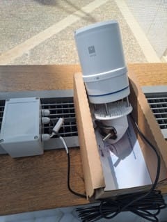
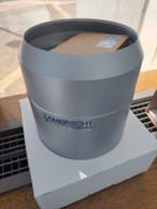
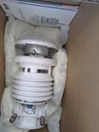
In the context of the EXCELSIOR project, the ERATOSTHENES Centre of Excellence (ECoE) has acquired a series of high-quality instruments to obtain long-term measurements of cloud and aerosol properties, precipitation, and related atmospheric characteristics in diverse climate regimes of Cyprus. The Atmospheric Cluster of the Department of Climate and Environment of the ECoE coordinates the Cyprus Atmospheric Remote Sensing Observatory (CARO). CARO as a national facility consists of a multi-instrument platform that is unique with the latest modern standards and is only available in few regions globally.
A comprehensive suite of cutting-edge instrumentation is deployed at the CARO to measure clouds, aerosols, radiation, and their interactions. CARO is a National Facility (NF) for remote sensing of aerosol and clouds and planned to become a ACTRIS National Research Infrastructure facility for Cyprus consisting of the aerosol remote sensing (ARS) observational platform and the cloud remote sensing (CRS) observational platform. Located in the center of Limassol, Cyprus, CARO currently operates a multiwavelength Raman LiDAR PollyXT-Cyp for aerosol profiling, a scanning Doppler LiDAR for wind profiling and the sun/sky photometer of the Aerosol Robotic Network, a 35 GHz cloud radar, microwave radiometer, a disdrometer and a ceilometer.
CARO is one of the most advanced facilities placed in the EMMENA region with high interest on atmospheric composition structure.
The CARO’s instruments are continually in operation to obtain long-term measurements of cloud and aerosol properties, precipitation, and related atmospheric characterization in the region’s diverse climate regimes. The state of instrumentation of CARO as of October 2024, is illustrated in the following.
PollyXT
A multi-wavelength dual field of view Raman polarization Lidar >> Dual-FOV PollyXT
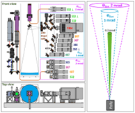
The Raman polarization lidar PollyXT-CYP, has been set up in Limassol at the ECoE-CARO premises for continuous operation under the EXCELSIOR project. This lidar has equipped with new state-of-the-art dual field of view technique and performing continuous recording from October 2020. The system is part of the Polly Network (PollyNET; pollynet.tropos.de) and the PollyXT-CYP lidar real-time observation can be accessed on the PollyNet website.
Doppler Radar
A 35-GHz scanning polarimetric cloud Doppler radar >> Mira-35
A meteorological Ka-Band cloud radar MIRA35 has been set up at the ECoE-CARO premises as a milestone to the establishment of the CARO national facility (CARO-NF). This radar was installed in cooperation with the remote sensing department of the Leibniz Institute for Tropospheric Research (TROPOS) and performs continuous recording since June 2024. Cloud radars are key devices of the ECoE-CARO GBS to determine the structure of clouds which cannot be penetrated by lidars. The MIRA35-CYP radar real-time observation can be accessed on the CLOUDNET portal.

Doppler Lidar
A Streamline-XR Doppler lidar>> Snoopy
A Halo Streamline-XR doppler wind lidar has been set up at the ECoE-CARO ground-based station at Limassol since February 2023. The instrument performs vertical as well as scanning measurements. This wind dataset is vital to perform successful aerosol-cloud interaction studies based on the measurement conduct with upgraded aerosol-cloud lidar (Part A, B) in combination with a doppler lidar. Within the context of the ECoE-CARO observations, the doppler lidar will show the occurrence of gravity wave structures with a pronounced updraft period. The Snoopy-CYP doppler lidar real-time observation can be accessed here.

Ceilometer
A 1064-nm ceilometer >> CHM 15kx
A Ceilometer of type CHM 15k of Jenoptik company has been set up at the ECoE-CARO ground-based remote sensing laboratory from January 2024. Originally, ceilometers are used for the detection of the cloud base height, but they can also serve for determination of aerosol properties. Besides PollyXT, the ceilometer is a central part of Cloudnet to receive continuous information about the height of cloud and aerosol layers. The ECoE-CARO ceilometer real-time observation can be accessed on the CLOUDNET platform
Microwave Radiometer
A 14-channel microwave radiometer>> HATPRO G5
A high-precision microwave radiometer of type HATPRO G5 has been installed at the ECoE-CARO station from June 2024. As a passive instrument, this microwave radiometer (MWR) is used to measure several atmospheric quantities, such as the cloud liquid water path, column-integrated water vapor, cloud base height, brightness temperature as well as temperature and humidity profiles of the lower troposphere. The ECoE-CARO microwave radiometer HATPRO G5 real-time observation can be accessed on CLOUDNET platform
Disdrometer
An optical 1-d precipitation disdrometer>> PARSIVEL
A Parsivel disdrometer manufactured by OTT Hydromet Inc (Parsivel2) has been installed at the ECoE-CARO station since January 2024. Parsivel2 uses a 780 nm laser beam which is 180 mm long, 30 mm wide and 1 mm thick on average. Disdrometers (DD) measure the size distribution and falling velocity of precipitation at the surface. The measured drop size distribution is then used to derive the size distribution and reflectivity. The ECoE-CARO Parsivel real-time observation can be accessed through the CLOUDNET portal.

Sun-Photometer
A CUT-TEPAK AERONET Sun-photometer>> CUT-TEPAK CE318
Long-term aerosol observation has been operating by the CUT-TEPAK AERONET sunphotometer since 2010 at Limassol. This sunphotometer is now part of the ECoE-CARO ground-based station and it calculates base parameters of AERONET such as the optical thickness. Aerosol optical depth data are computed for three data quality levels: Level 1.0 (unscreened), Level 1.5 (cloud-screened), and Level 2.0 (cloud-screened and quality-assured). The CUT-TEPAK AERONET sunphotometer performs continuous recordings and its result can be accessed on the AERONET platform.

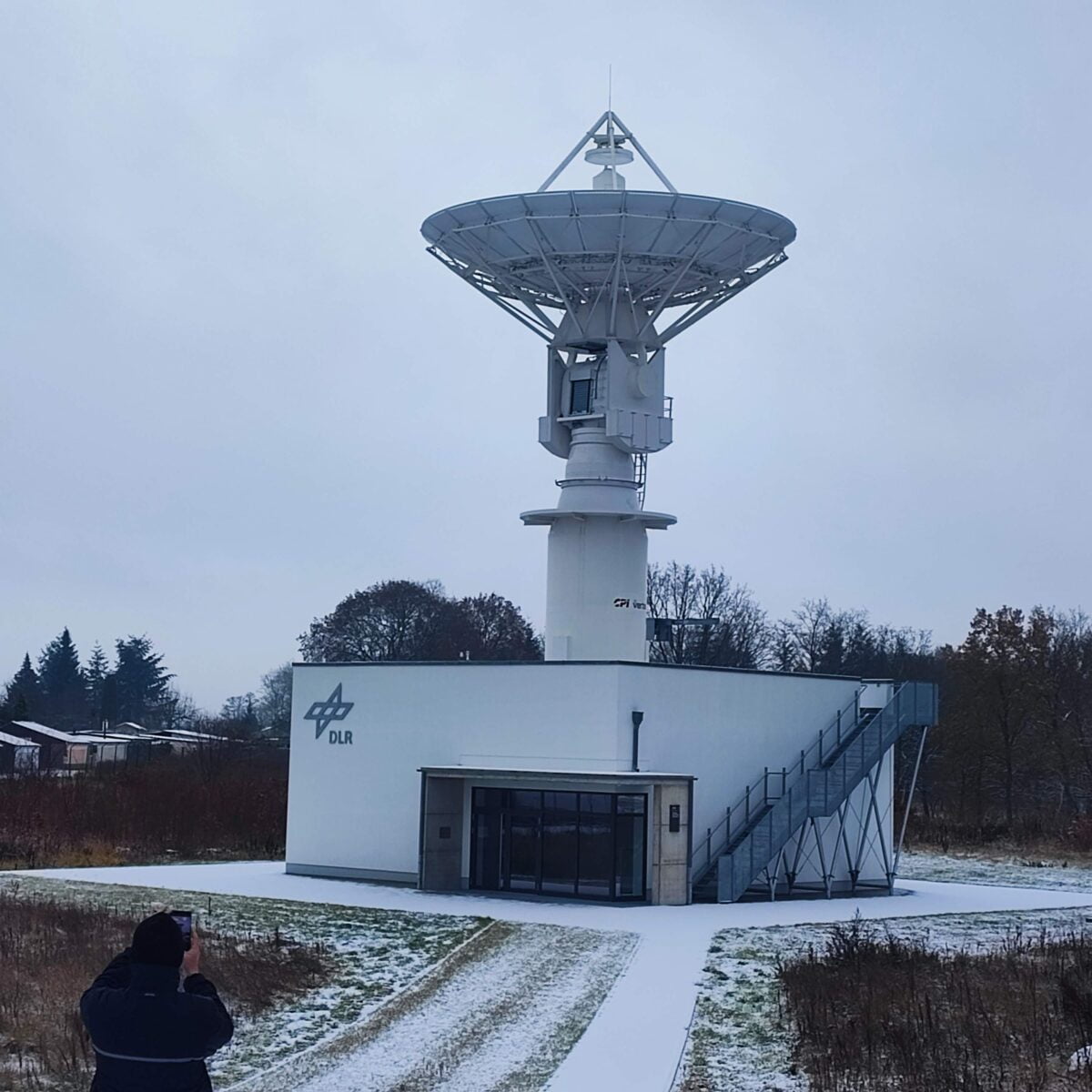
EARTH OBSERVATION SATELLITE DATA ACQUISITION STATION HOSTING (DAS)
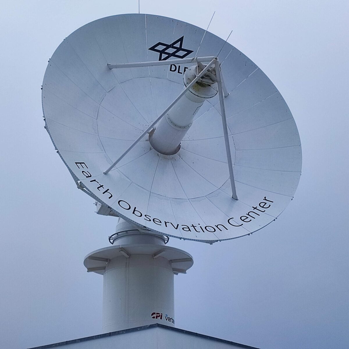
ERATOSTHENES Centre of Excellence is in the process of establishing the first Earth Observation Data Acquisition Station (DAS) in Cyprus. A place with unique geostrategic position at the crossroads of three continents and with excellent weather conditions that can contribute significantly to various sectors of Earth Observation in the EMMENA region.
The DAS will be equipped with a three-band feed and capabilities for simultaneous reception of all three bands (S, X and Ka) making it suitable to support current as well as future missions. The size of the reflector will allow the station to successfully meet the stringent criteria set up by International and National bodies in terms of service availability and reception margins. The electromechanical structure of the antenna will allow tracking and acquisition of data from satellites orbiting as low as 400km above the surface of the Earth. The station will be hosted on one of Cyta’s fully developed Teleports. The proposed infrastructure will consist of State-of-the-Art facilities for acquisition, processing and storage of data. Data can be securely transported through Cyta’s extensive fiber network that offers interconnectivity to major European and Global Hubs.
The procurement of the DAS will allow the Center:
To downlink data for its own use
To create products and services for scientists and users in EMMENA region
To generate EO-based NRT Services (e.g. maritime)
To serve International Partners and Satellite Operators
To provide Backup services, satellite control services
Known players such as DLR and CYTA have a prominent role in the successful installation, commissioning, testing and operation of the DAS.
The Business Plan is a necessary tool that enables the Centre to:
Identify opportunities and market segments
Understand main players, competitors and partners
Evaluate risks at early stages and ways to mitigate these
Set financial targets
After the tender submission, an intensive effort by the Evaluation Committee of the tender took place. The evaluation report was finalized on July. At the first meeting, the formal conditions for the tenderers’ participation were examined and some clarifications were asked. At the second meeting, the technical specifications were checked as presented by each Tenderer, and some clarifications were asked again. Finally, the third meeting was dedicated to the evaluation of the financial offers. The final ranking of the bids was revealed and the successful Tenderer was recommended to the Eratosthenes BoD.
The successful tenderer was informed on September 2023 after ERATOSTHENES CoE’s BoD decision to award the contract to Safran Data Systems.
THE SOLAR INFRASTRUCTURE EQUIPMENT
The Cyprus Solar Network (CSN) is a ground-based network consisting of five stations designed for monitoring solar energy and solar ultraviolet (UV) radiation. These stations have been strategically selected to cover different geographical areas within the Republic of Cyprus. The central station is located in Limassol, with the other four stations located in Polis Chrysohous, Kyperounta, Athalassa, and Xylofagou.
- A Bentham DMc150 double monochromator spectrophotometer: This high-precision instrument is used for UV/VIS spectral solar irradiance measurements, providing detailed data on solar radiation across different wavelengths.
- A radiation station: This station measures several key components of solar radiation, including shortwave downwelling irradiance components such as global, direct, and diffuse solar radiation. Additionally, it measures longwave downwelling irradiance, which is important for understanding the energy balance of the Earth’s surface.
- A sky imager: The sky imager is used to monitor cloud coverage, allowing for a better understanding of how cloud conditions impact solar radiation and aiding in the prediction of solar energy generation under varying weather conditions.
- A calibration system: To ensure the accuracy and reliability of measurements, the station employs a calibration system with three PTB Transfer Standard Lamps. These lamps serve as traceable standards and are used for the calibration of the spectrophotometer, maintaining the high quality of the measurements.
The other four stations (Polis Chrysohous, Kyperounta, Athalassa, and Xylofagou) primarily provide measurements of global shortwave downwelling irradiance and erythemal UV irradiance. This distributed network of stations offers a comprehensive assessment of solar conditions in various regions of Cyprus, making it a valuable resource for researchers and organizations interested in solar energy and UV radiation monitoring in the area.

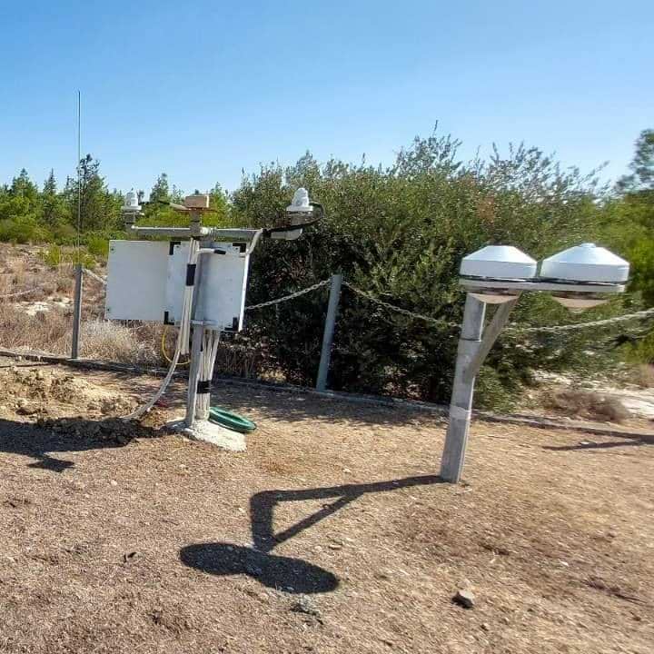
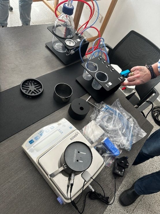
EQUIPMENT FOR THE AGRICULTURE SECTOR
A recent open procurement procedure (Q3 2023) for the acquisition of the Agriculture equipment of the ERATOSTHENES Centre of Excellence has been issued on September 2023. All necessary legislative steps were followed such as market research, preparation of detailed specifications and drafting of tender documents. The tender submission has been planned for the October 2023.
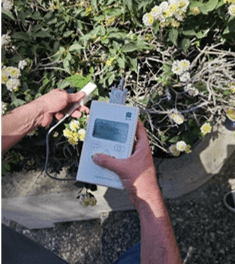
Field and laboratory equipment for the Agriculture applications
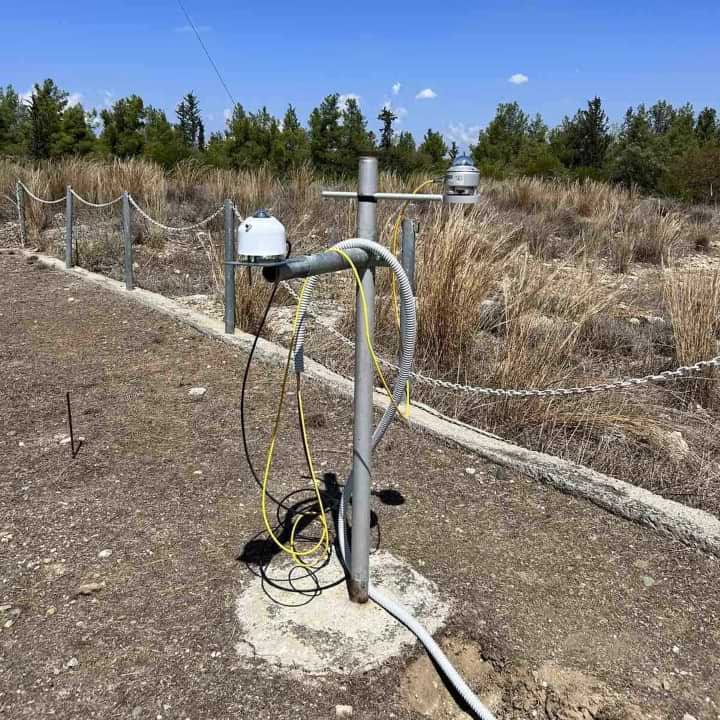
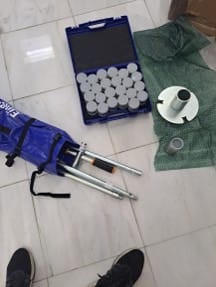
- The field and laboratory equipment purchased after an open tender procedure of the tender 019/2023 “Agricultural equipment” on 20/10/2023 for measuring basic soil – water – plant parameters (hydraulic conductivity, soil texture and water potential, soil pH, leaf area index, leaf stomatal conductance, groundwater level).
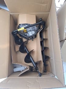
- Additional field equipment purchased after an open tender procedure of the tender 014/2024 “Agricultural equipment II” on 20/10/2023 for further enhancing the soil – water – plant measurement capabilities. The equipment includes soil moisture and soil water potential sensors, sap flow sensors, earth auger, undisturbed soil sampling kit, meteorological sensors, the CARBONICA field toolkit, soil respiration and actual evapotranspiration systems.
GEODETIC EQUIPMENT
A new open procurement procedure for the acquisition of the Geodetic equipment of the ERATOSTHENES CoE (Q4 2023) is being prepared. In this stage, the market research has been concluded and the Specification Committee is preparing the detailed specifications according to the requirements of “The 2016 law on the coordination of the procedures for the award of public contracts for supplies, works and services and for related issues, 73(I)/2016”. This tender it is planned to be finalized and issued by the end of October 2023.
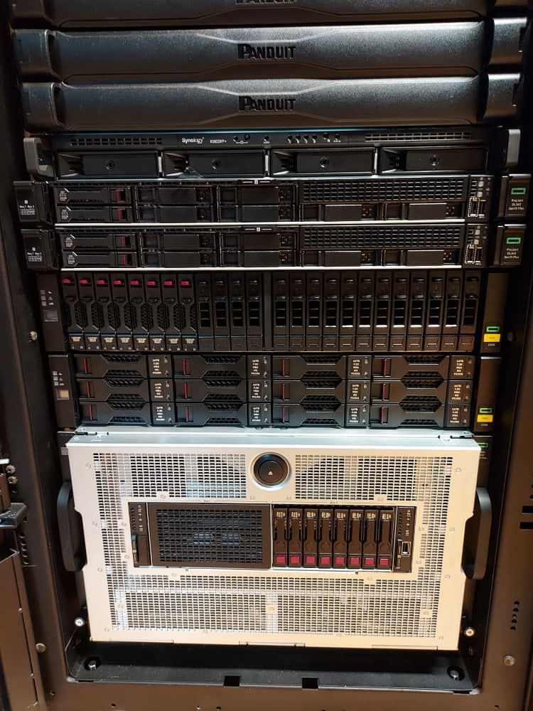
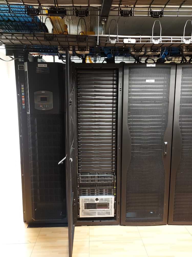
COMPUTING CLUSTER INFRASTRUCTURE
The ERATOSTHENES Centre of Excellence (ERATOSTHENES CoE), is establishing its computing and server infrastructure at the CUT Data Centre. Specialized servers and workstations were included in the procurement.
An open tender procedure was carried out successfully. The contract signed and the equipment was installed successfully.
USE OUR INFRASTRUCTURE UPON REQUEST

Contact Information
- Dr. Andreas Christofi
- Administration Manager
- andreas.christofe@eratosthenes.org.cy
- +357 25002908
Terms of use
Information on terms of use, cooperation and fees is provided upon request. All such information is defined in a collaboration agreement.