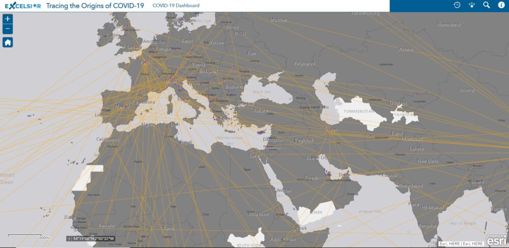
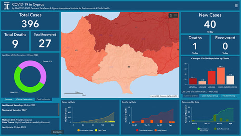
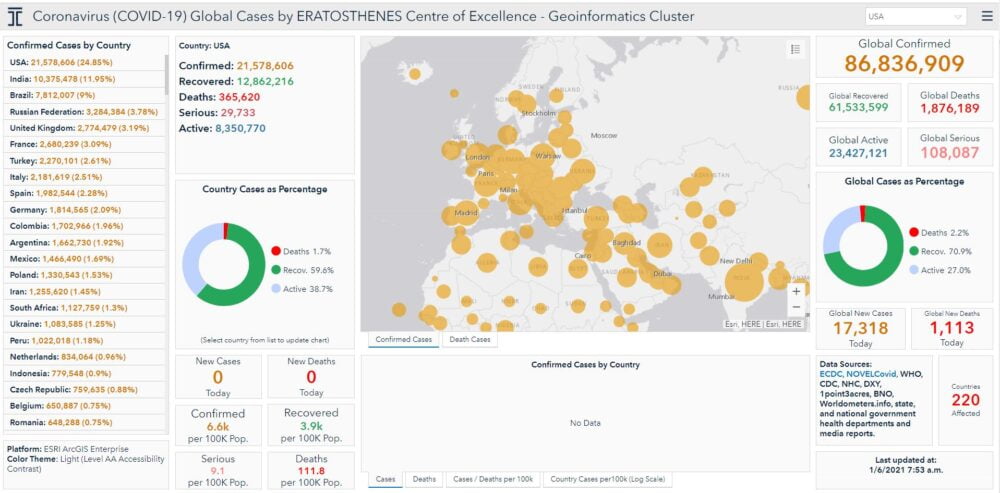
The Eratosthenes Centre of Excellence and the EXCELSIOR Project have launched a WebGIS platform to trace the origins of COVID-19 pandemic. The main objective of the ERATOSTHENES COVID-19 WebGIS Platform was to illustrate the spread of the COVID-19 pandemic, disseminate useful statistical figures to the Governing Departments and Authorities and inform the public.
The platform is available at:
👉Coronavirus (COVID-19) Cases in Cyprus by ERATOSTHENES Centre of Excellence / EXCELSIOR H2020
👉Coronavirus (COVID-19) Global Cases by ERATOSTHENES Centre of Excellence – Geoinformatics Cluster
👉Tracing the Origins of COVID-19